
Smoke In Wenatchee Valley To Leave With Big Weather Change
There's more smoke in the forecast for the next two days in the Wenatchee Valley, but a big change is on the way.
National Weather Service Meteorologist Jeremy Wolf says the first snow storm of the fall will hit the Cascades by Friday, which will be a game changer for the entire area.
"The precipitation will be welcome news for the fires, and then push the smoke out of the area, so (we) should see major improvement to the air quality situation," said Wolf.
Three inches of snow will likely fall in the Cascades, while there's still not certain whether Wenatchee will see any rain over the weekend.
Wind that’ll accompany the storm will also help to clear out the smoke, which has also hit the west side of the state in the last week or so because west side wildfires ignited in early October.
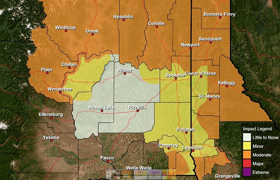
In fact, the Pacific Northwest is currently experiencing the worst air quality in the country. Residents across Washington and most of Oregon are currently advised to avoid spending too much time outdoors.
The storm in the Cascades should bring snow to Snoqualmie Pass, Stevens Pass and Blewett Pass. Snow levels will drop to 2700 feet Sunday morning, rising to 3900 feet in the afternoon.
More From Washington State News