
Is The Great Entiat Earthquake Of 1872 Lurking To Strike Again?
Will the great Entiat earthquake of 1872 repeat and happen again?
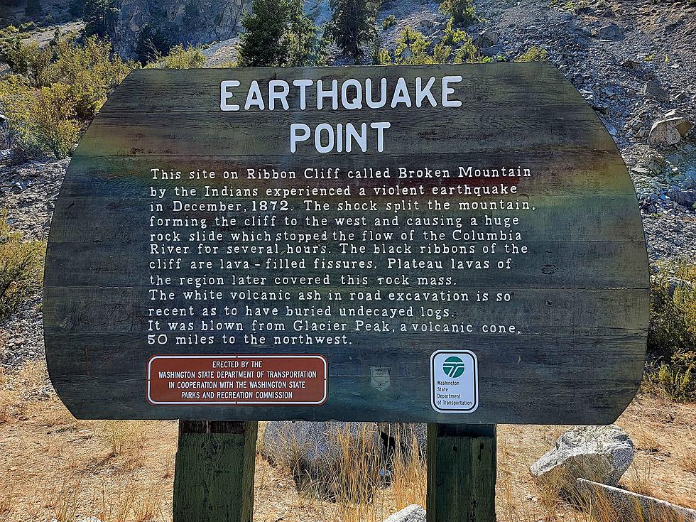
One of the largest known earthquakes in the Pacific Northwest - The 1872 North Cascades Earthquake, occurred on December 15, 1872.
Recent estimates revealed in a 2021 research paper by Brian L. Sherrod, Richard J. Blakely, and Craig S. Weaver of the United States Geological Survey suggest the 1872 quake had a magnitude between 6.5 and 7.0.
The USGS (United States Geological Survey) team of Sherrod, Blakely, and Weaver used LiDAR (Light Detection And Ranging) and Paleoseismology in and around Entiat. Their study has uncovered evidence with future implications for our region.
Two breakthrough findings from this study include
1) The Spencer Canyon Fault:
This shallow fault line, seen below, cradles itself around Entiat. The total length of the fault line is just under 50 miles.
The area around the Spencer Canyon fault line is continually active with minor tremors. The Pacific Northwest Seismic Network has observed 6 small seismic events of less than magnitude 1.0 in the past two weeks.
Since 1970, there have been 1,400 recorded small to medium-sized earthquakes around Entiat, ranging between magnitude 1.0 to 4.3 on the Richter scale.
The 46-mile-long Spencer Canyon fault was likely responsible for the 1872 earthquake near Entiat.
2) Data Suggests that a Magnitude 7.0 earthquake along the Spencer Canyon fault has taken place - on average, every 200 years and will repeat.
'The fault zone (gives way) to a Magnitude∼7 earthquake every 200 years on average (McCaffrey et al., 2013). The concentration of ongoing seismicity beneath the town of Entiat suggests that the fault zone remains active today and may pose future threats. Our findings have implications for nine hydroelectric and/or irrigation storage dams and two nuclear facilities within 100 miles of the fault.' -Brian L. Sherrod, Richard J. Blakely, Craig S. Weaver of the United States Geological Survey
INFO SOURCE: Brian L. Sherrod, Richard J. Blakely, Craig S. Weaver of the United States Geological Survey's Research paper: "LiDAR and Paleoseismology Solve Earthquake Mystery in the Pacific Northwest, USA" (2021)
The 7 Worst Natural Disasters in the History of Washington State
Gallery Credit: Rik Mikals
Colorado's Worst Natural Disaster: The Big Thompson Flood of 1976
Gallery Credit: Zane Mathews
More From Washington State News