
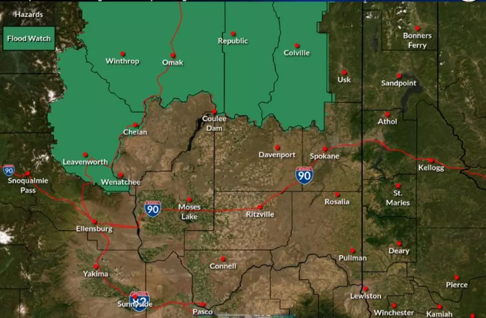
Flood Watch In Effect For Chelan, Okanogan Counties
There's still smoky air in parts of North Central Washington, and now there's a flood watch as well.
The watch covers the east slopes of the Cascades and the mountainous areas across the Okanogan Highlands.
Steven Van Horn with the National Weather Service says the flooding could occur where there's steeper terrain or burn scars from previous wildfires.

“Eventually, even though we’re not looking at a wide spread shower or thunderstorm event, if those storms do occur in those places where the terrain is steeper or over a burn scar, there could be some problems when it comes to flash flooding or debris flows,” said Van Horn.
The chances of rain are less than 50 percent, but the slow-moving thunderstorms could bring heavy showers.
The watch is in place because of possible slow-moving thunderstorms that could lead to flooding where slopes are steep or there are burn scars from previous fires.
The flood watch is in effect from 2pm Tuesday through 11 pm Wednesday.
Horn says smoky weather will also stay with us into Wednesday night.

“As we start getting into Wednesday and Wednesday night, it’s really more localized to where the current large fires are, unless we get a new fire that starts,” Van Horn said. “And of course, we can’t predict where that might be.”
The air quality is expected to improve across the region by late this week.
As of Tuesday morning, much of Eastern Washington had "unhealthy" air quality with some locations reporting the less severe "unhealthy for sensitive groups."
More From Washington State News